
BY KELLY ROCHE
Get those shovels and ice scrapers ready — 10 to 15 cms of snow is expected to cover southern Ontario Monday night, according to Environment Canada.
A ‘Texas Low’ will spread snow, ice pellets, and blowing snow our way Monday evening, changing to freezing rain early Tuesday, which will then become rain or drizzle throughout the day.
A winter storm watch was issued Sunday afternoon, covering Peel, Halton, and the rest of the Greater Toronto Area, reaching all the way to Ottawa.
In addition, strong easterly winds gusting to 70 km/h are expected Monday evening — south Mississauga, Oakville, and Burlington residents may see gusts to 80 km/h near Lake Ontario.
“Travel conditions are expected to rapidly deteriorate Monday evening as visibilities drop to near zero and roads become covered in snow and ice pellets,” reads the Enivronment Canada statement.
“Significant disruption to travel may persist into Tuesday.”
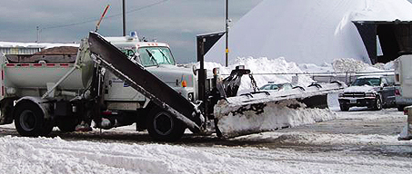
The city of Mississauga’s winter maintenance crews have been prepared to handle snow since November.
Residents can download the city’s roads app to track snow plows and salters in your neighbourhood.
Peel Police are reminding residents to make sure their vehicles are winter-ready.

